
The Met Office has issued yellow weather warnings for 106 areas across the UK, with thunderstorms bringing hail, frequent lightning, and winds of up to 60mph expected from midnight on Thursday. Two separate warnings will come into force during Thursday night into Friday morning as the weather turns more unsettled following the peak of the heatwave.
Heatwave peak gives way to storms
While Thursday is forecast to be the peak of the heatwave, with temperatures reaching the mid-30s Celsius in parts of northern England and highs of around 38C across the Midlands, southeast Wales, and southern England, a change in the weather is expected across large swathes of the UK by tonight. The Met Office said a shift in the jet stream will bring an area of lower pressure from the west, introducing more cloud and the potential for rain showers and thunderstorms.
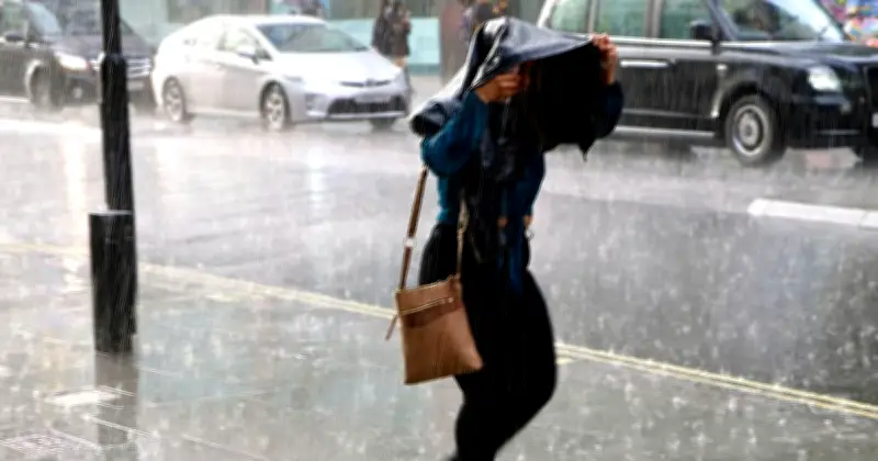
Thunderstorms develop when the hot, humid air becomes unstable, which can lead to heavy downpours, lightning, hail, and gusty winds. This changeable weather is expected across parts of England, Wales, and Scotland this evening, with two thunderstorm warnings due to come into effect at midnight.

Warning details and timing
The warning for Scotland will be in force from midnight until 23:59 on Friday, while the warning for parts of England and Wales will be in effect from midnight until 10:00 on Friday morning. The storms are expected to produce sudden, gusty winds of up to 60mph, particularly in the south and west, as well as frequent lightning, hail, and heavy rain.
In its forecast, the Met Office said: “Thunderstorms are expected to move northeastwards across parts of England and Wales during the early hours of Friday, clearing during Friday morning. Whilst many areas will miss them, thunderstorms may produce sudden, gusty winds with 50 to 60 mph possible, particularly in the south and west of the warning area. Frequent lightning, hail and heavy rain (possibly 15-20 mm in an hour) are additional hazards.”
Impacts and advice
The unsettled weather brings a risk of spray and sudden flooding, possible power cuts, travel delays and cancellations to rail and bus services, and potential damage to homes. Households in the warning areas are advised to prepare by securing outdoor items, including trampolines, bins, sheds, garden furniture, and fences, and gathering torches, batteries, mobile phone power packs, and chargers in case of a loss of power.
Warning of heavy rain and thunderstorms in Scotland, the Met Office said: “Spells of heavy rain and thunderstorms initially over northwest Scotland are likely to become more widespread during Friday morning. Further thunderstorms and spells of heavy rain are possible in the afternoon before becoming confined to more northern areas of Scotland later in the day. Rainfall amounts will be highly variable but narrow corridors of 20-30 mm falling in 1 hour and potentially 30-50 mm in 3 hours is possible. Frequent lightning, large hail (2-4 cm diameter) and locally gusty winds with stronger storms.”
Full list of areas under yellow warning for thunderstorms from midnight until 10am Friday: England and Wales
East Midlands: Derby, Derbyshire, Leicestershire, Nottingham, Nottinghamshire.
London & South East England: Hampshire, Oxfordshire.
North East England: Darlington, Durham, Gateshead, Hartlepool, Middlesbrough, Newcastle upon Tyne, North Tyneside, Northumberland, Redcar and Cleveland, South Tyneside, Stockton-on-Tees, Sunderland.
North West England: Blackburn with Darwen, Blackpool, Cheshire East, Cheshire West and Chester, Cumbria, Greater Manchester, Halton, Lancashire, Merseyside, Warrington.
South West England: Bath and North East Somerset, Bournemouth Christchurch and Poole, Bristol, Devon, Dorset, Gloucestershire, North Somerset, Somerset, South Gloucestershire, Swindon, Torbay, Wiltshire.
Wales: Blaenau Gwent, Bridgend, Caerphilly, Cardiff, Carmarthenshire, Ceredigion, Conwy, Denbighshire, Flintshire, Gwynedd, Merthyr Tydfil, Monmouthshire, Neath Port Talbot, Newport, Powys, Rhondda Cynon Taf, Swansea, Torfaen, Vale of Glamorgan, Wrexham.

West Midlands: Herefordshire, Shropshire, Staffordshire, Stoke-on-Trent, Telford and Wrekin, Warwickshire, West Midlands Conurbation, Worcestershire.
Yorkshire & Humber: East Riding of Yorkshire, North Lincolnshire, North Yorkshire, South Yorkshire, West Yorkshire, York.
Full list of areas under yellow warning for thunderstorms from midnight until 23:59 Friday: Scotland
Central, Tayside & Fife: Angus, Clackmannanshire, Dundee, Falkirk, Fife, Perth and Kinross, Stirling.
Grampian: Aberdeen, Aberdeenshire, Moray.
Highlands & Eilean Siar: Na h-Eileanan Siar, Highland.
Orkney & Shetland: Orkney Islands.
SW Scotland, Lothian Borders: Dumfries and Galloway, East Lothian, Edinburgh, Midlothian Council, Scottish Borders, West Lothian.
Strathclyde: Argyll and Bute, East Ayrshire, East Dunbartonshire, East Renfrewshire, Glasgow, Inverclyde, North Ayrshire, North Lanarkshire, Renfrewshire, South Ayrshire, South Lanarkshire, West Dunbartonshire.