


Entertainment

Appleton Sisters on All Saints, New Music, and Nineties Memories
Natalie and Nicole Appleton discuss their new duo music, All Saints years, Honest film, and why they'd relive the Nineties despite the traumas.


Politics

Teen Driver Who Killed Boyfriend in 100mph Crash Begged for iPad, Fame Behind Bars
Mackenzie Shirilla, convicted of murdering her boyfriend and friend in a 100mph crash, made self-centered demands from jail, including her iPad and fame, as revealed in phone calls.


Sports

Man Utd May Use Rashford in Swap Deals for Leao or Casado
Manchester United are considering two swap deals involving Marcus Rashford, with AC Milan's Rafael Leao and Barcelona's Marc Casado as potential targets.


Crime

No Evidence Found in Search for Missing Boy Gus Lamont After 11 Searches
Police have found no evidence in the latest search for missing boy Gus Lamont, eight months after his disappearance. One grandparent remains a suspect.


Health


Environment

Global Temp May Reach 1.9C Above Pre-Industrial by 2030
New UN climate predictions show a 75% chance the 2026-2030 average will exceed 1.5C, with annual temperatures potentially reaching 1.9C above pre-industrial levels.

How to Find Truly Sustainable Jeans: A Guide
Learn how to identify genuinely sustainable jeans amid greenwashing, from cotton farming to finishing processes, and why buying secondhand is the best option.

UN Warns Next Five Years Will Shatter Temperature Records
The UN predicts a 75% chance that global temperatures will exceed 1.5°C above pre-industrial levels between 2026-2030, with severe consequences including extreme weather and Arctic warming.

Met Office Warns Record Heat for Five Years
UK scientists warn global temperature records will be smashed for at least five more years, with a 75% chance of exceeding the 1.5°C Paris limit between 2026-2030.
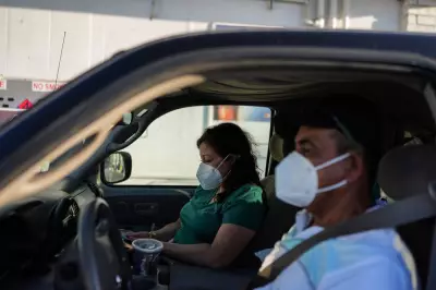
Calif. chemical tank evacuation lifted but fears persist
Thousands return home after California chemical tank threat, but fears linger over safety and accountability. Residents remain on edge near the aerospace plant.
UK Geography Mastery: Wednesday Test
How well do you know UK geography? Take our Wednesday test covering all aspects of British physical and human geography with 100 multiple-choice questions.
